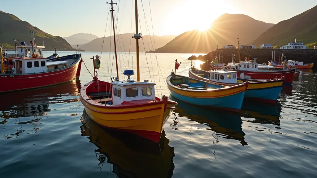
Dingle Harbour Loop: A Gentle Waterfront Stroll
Two-mile flat walk around the harbour with plenty of benches, ice cream stops, and fishing village charm. Perfect for a relaxed afternoon.
Read MoreStop-and-stroll tour along one of Europe's most stunning coastlines. We've mapped the best pullouts, parking spots, and short walking sections for comfort.

Slea Head Drive isn't a single walk—it's a 30-kilometre loop that hugs the western tip of the Dingle Peninsula. You'll get dramatic sea cliffs, ancient monastic sites, and coastal villages that haven't changed much in generations. Best part? You don't need to be a serious hiker. There's parking at nearly every stunning viewpoint, plus short walking sections you can do at your own pace.
The route takes you from Dingle town around to Dunquin and back, passing Ventry Beach, Dunmore Head, and the Skellig Islands views. We've walked it in sections over a few visits—you can absolutely do the whole thing in a day if you're fit, but we prefer to break it up. More time means better light for photos, proper breaks at the cafés, and actually absorbing the landscape instead of rushing through it.
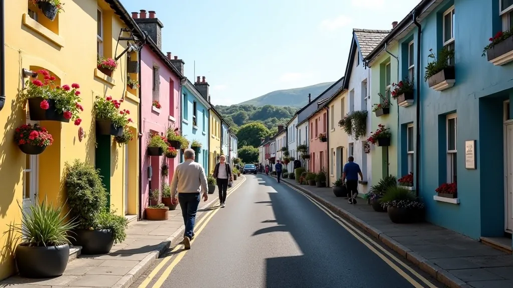
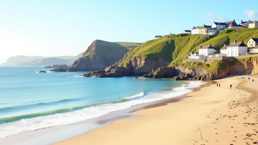
The first section of Slea Head Drive starts in Dingle town and heads west along the R559. It's a straightforward drive with plenty of pullouts. Stop at Dingle Harbour first if you haven't already—the town itself is worth exploring on foot before you tackle the peninsula drive.
Ventry Beach is about 10 kilometres west. It's a proper sandy beach with a car park right beside it. The walk here is simple—just park and stroll along the shore. The beach faces west toward the Atlantic, so if the weather's clear, you'll get stunning light in the late afternoon. We usually spend 30 minutes here, depending on how talkative the locals are at the café.
There's a small village at Ventry with a shop and café. Nothing fancy, but the views are the real draw. The cliffs rise up behind the beach, and on clear days you can see all the way to the Skellig Islands. Bring water and a light snack—you'll want to settle in and just look at the view for a bit.
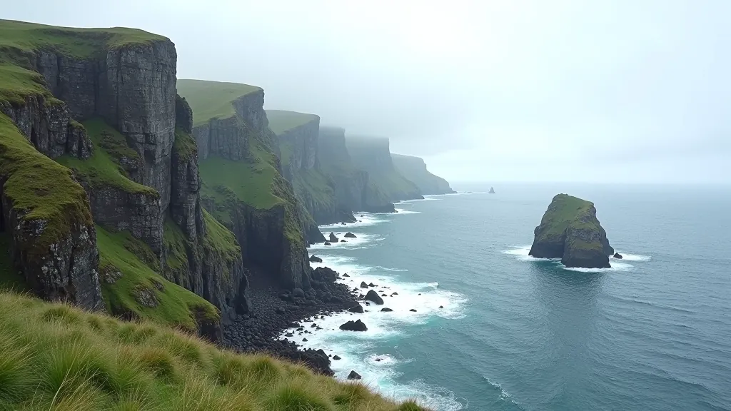
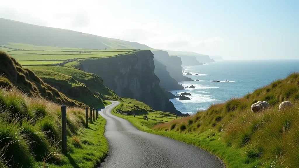
Continue west from Ventry for another 8 kilometres and you'll reach Dunmore Head. This is where things get properly dramatic. The car park sits at the top of serious cliffs—we're talking 200+ metres straight down to the Atlantic. Don't worry, there's fencing, but it's still worth taking your time and being careful with footing if it's wet.
From here, on a clear day, you can see Skellig Michael—that famous island monastery from the Star Wars films. The walk from the car park is about 10 minutes flat along the clifftop path. You'll pass some ancient monastic sites (oratories, they're called) that're hundreds of years old. The stones are still standing. It's humbling, honestly. Monks lived out here for years, praying and surviving on what the land gave them.
The views are the real attraction though. The Atlantic stretches out in front of you. On windy days—and it's often windy here—you'll feel genuinely exposed in the best way. Bring a windproof jacket. And if you've got a camera, bring it. The light changes constantly, and golden hour here is something else.
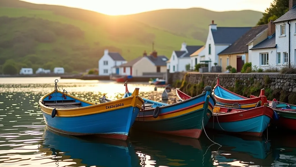
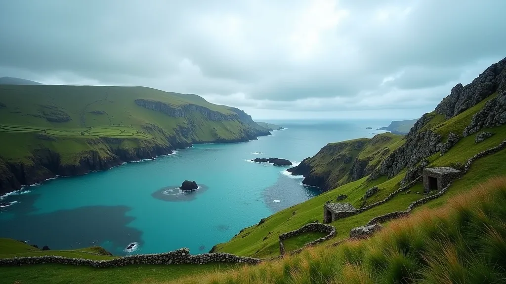
Dunquin is the next proper village—it's another 5 kilometres further west. This is genuinely the edge of Ireland. The village is small but has a couple of cafés and shops. There's also a ferry that goes out to the Blasket Islands if you want to make a day of it, though the islands are mostly ruined villages now. It's atmospheric if you're into that kind of thing.
The car park at Dunquin gives you access to the clifftop walk down to the old pier. It's not steep, but it's uneven and can be slippery. There's a proper path though. You'll walk through an old village site—stone walls, abandoned houses. The islanders were evacuated in the 1950s. Some families still have relatives in Dunquin, and you'll sometimes see them coming back to visit family graves on the islands.
We usually spend an hour here. There's a small café called Kruger's that does excellent coffee and has the best view of any café in Ireland. Sit outside if the weather allows. It's cold and windy, but it's worth it.
The entire loop takes about 2-3 hours of driving if you stop frequently. We'd recommend allowing 6-8 hours for a proper visit—parking, walking, cafés, exploring. It's not a race. The route is scenic enough that you won't get bored driving it, and every car park offers something worth seeing.
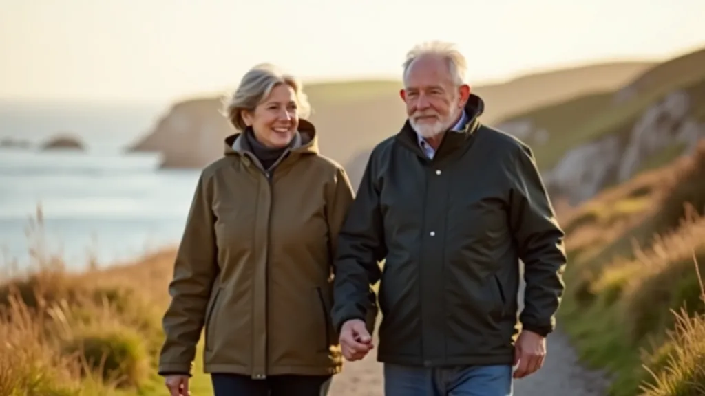
Weather changes fast out here. You'll start the morning with blue skies and end up in mist by afternoon. Bring layers—a windproof jacket is essential. The wind can be fierce, especially at Dunmore Head. Comfortable walking shoes with good grip matter more than fancy hiking boots. Most of the walks are short and relatively flat, but the ground gets wet and uneven.
Parking is free at most spots, though some car parks have small donations (a euro or two). There's petrol in Dingle before you start. Mobile signal can be patchy once you're out on the peninsula, so don't rely on GPS navigation. The road is well-marked though, and locals are always happy to point you in the right direction if you get turned around.
Slea Head Drive isn't just a scenic drive—it's a journey through real Irish landscape where people have lived and worked for centuries. The cliffs, the light, the ancient sites, the hospitality at the cafés—it all comes together into something memorable. You don't need to be fit or experienced to enjoy it. The route is designed so you can go at your own pace, stopping whenever something catches your eye.
We've done this drive in summer, spring, and winter. It's different every time. The light changes, the weather surprises you, and you notice different details. That's what keeps bringing us back. It's one of those rare places where the reality matches the photographs. Better than the photographs, actually, because you're there in it.
Plan a full day. Bring good shoes, layers, and patience. Don't rush between stops. Sit for a bit at each viewpoint. Talk to the people at the cafés—they've got stories about the land and the islands. That's where the real experience happens. Not in getting through the drive, but in taking time to be present in one of Europe's most beautiful places.
This article provides educational information about Slea Head Drive based on documented routes and general travel guidance. Weather conditions, road conditions, and local circumstances can change. Always check current weather forecasts before visiting. Coastal areas can be dangerous—stay behind fences, watch your footing on wet surfaces, and supervise children carefully. This information is intended to help with planning but doesn't replace local knowledge or professional travel advice. Visit the official Dingle Peninsula tourism website for current conditions and seasonal information.